...
| View | Description |
|---|---|
| (1) Node Filter | List of filters to be applied to the nodes table. |
| (2) Current Filters | Current filters applied to the nodes table. |
| (3) Nodes Table | Nodes table displaying filtered nodes. |
| (4) View in Network Map | Takes selected nodes to generate a Network Map. |
| (5) View in Geographical Map | Takes selected nodes to generate a Geographical Map. |
| (6) Search Filter | Search for specific Node Names, Hosts, Groups, or Locations. |
Geographical Map
Topo:
- if it’s a topo map opcharts puts the user into the map ‘creator’ because the topo maps aren’t very useful unless the user can right click and select “add subnets” or “add neighbours” etc and those functions aren’t available when just viewing the map.
- when the topo map is saved the dynamic flags are thrown away, the list of nodes that are on the map are saved into the map definition, it’s now ‘static’. There is no way to save a dynamic topo map right now (or ‘network map’ either)
- after saving can be added to dashboard
Geo:
- if it’s a geo map When choosing to display a Geographical Map using this method the user is sent to the ‘show’ 'Show' page for the map, not the map creator. This is done because the map generated is useful without any changes made to it. If the user wants you would like to save this map they can click the drop-down in the top right hand corner and select ‘Create 'Create static map’ map' or ‘Create dynamic map’
- if they select create static map the flow is pretty much the same as with topo, the 'Create dynamic map'. If you choose to create a static map the list of nodes in the map creator is saved into the map and won’t change again without the user editing the map. If the user sets a specific location and zoom that will also be saved into the map.
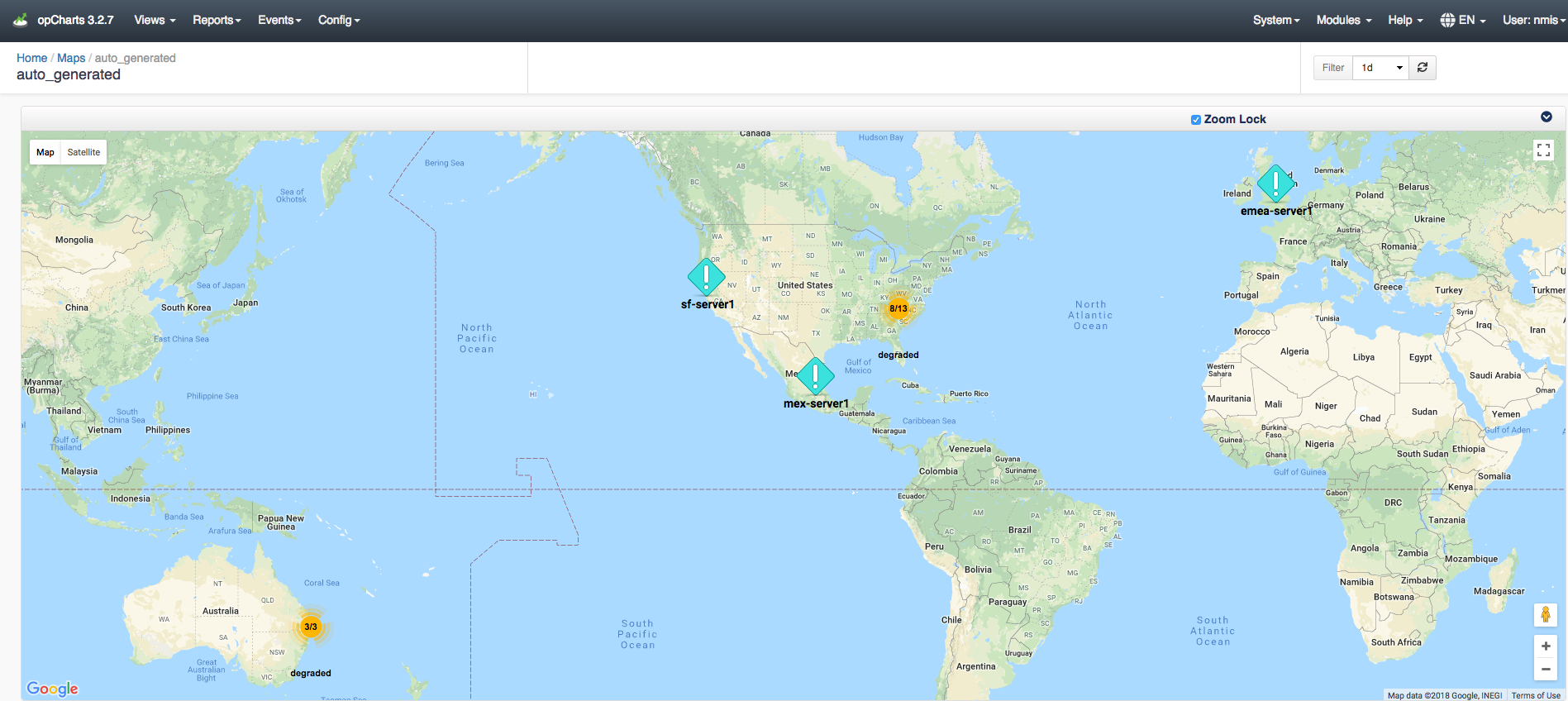
Creating a dynamic - if they select create dynamic map the map saves the ‘dynamic’ flag into the map as well as the filter used to create the map. When the map is saved the list of nodes is thrown away, their locations are thrown away, any changes made to the map view are basically thrown away. This is because everything in the map is dynamic, it’s generated from the filter. The user can only change the name, description, and title. In the map creator you’ll notice that all the “Component” buttons are grayed out and some text above them has been added "Components cannot be added to dynamic maps.” That is basically the only GUI cue that shows the user it’s a dynamic map. Things as shown in the image below. Things like positioning and zooming are not saved, when the map is loaded all matching nodes are added and then the map is told to make all nodes fit into the view.Both types of Geographical maps can be added to the Dashboard.

Topological Map
Topo:
- if it’s a topo map opcharts puts the user into the map ‘creator’ because the topo maps aren’t very useful unless the user can right click and select “add subnets” or “add neighbours” etc and those functions aren’t available when just viewing the map.
- when the topo map is saved the dynamic flags are thrown away, the list of nodes that are on the map are saved into the map definition, it’s now ‘static’. There is no way to save a dynamic topo map right now (or ‘network map’ either)
- after saving - both geo map types can be added to a dashboard.
Lastly, the list of nodes on a dynamic map only changes when the map is reloaded/the page is refreshed. Dashboards automatically refresh every X minutes, this refresh only updates the node status, it will not update the contents of the node.
...